SkyGuard-M1
ARMED WITH 1 AERIAL BOMB (81 MM)
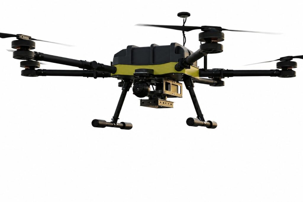
The SG-M1 ISR Tactical Quadcopter is a mission-ready unmanned aerial platform engineered for intelligence, surveillance, reconnaissance (ISR), and tactical payload deployment. Built around a rugged electric multirotor architecture, SG-M1 combines stabilized electro-optical imaging with autonomous flight capabilities to provide reliable situational awareness in demanding operational environments.
Designed for precision missions, the platform supports a single 81 mm aerial payload deployment while maintaining excellent flight stability and real-time video transmission. Its advanced navigation system, long endurance, and integrated day/thermal imaging make it an ideal force multiplier for defense and security operations.
Redefining Aerial Superiority
- ISR Surveillance
- Tactical Reconnaissance
- Precision Payload Deployment
- Real-Time Intelligence
- Day & Thermal Imaging
- Autonomous Flight
F2T2EA

Find
Detect and identify potential targets using long-range EO and thermal surveillance systems.

FIX
Maintain continuous tracking with stabilized gimbal imaging and precise GPS positioning.

TRACK
Provide persistent real-time monitoring of moving or stationary targets throughout the mission.

TARGET
Generate accurate target coordinates and support tactical decision-making with integrated sensors.

ENGAGE
Deploy a single 81 mm aerial payload with controlled precision during mission execution.

ASSESS
Conduct post-engagement battle damage assessment (BDA) and relay actionable intelligence to command units.
Operational Role
The SG-M1 ISR Tactical Quadcopter is designed to support military and security forces with real-time intelligence, surveillance, and precision payload deployment. Its autonomous flight capabilities, stabilized imaging system, and extended endurance make it suitable for a wide range of tactical missions.
SPECIFICATIONS
SkyGuard-M1
Mission Role
ISR & Tactical Payload Deployment
Payload
Single 81 mm Aerial Bomb
Flight Time
Up to 55 Minutes
Control Range
10 km
Imaging System
Day Camera + Thermal Imager
Laser Range Finder
Up to 3,000 m
| GENERAL SPECIFICATIONS | |
|---|---|
| Maximum Take-Off Weight | 10 kg ±0.5 kg (with 60 mm mortar bomb) or 12 kg ±0.5 kg (with 81 mm mortar bomb) |
| Total Weight of the System (RC, accessories) | 13 kg ±1.0 kg (with 60 mm mortar bomb) or 15 kg ±1.0 kg (with 81 mm mortar bomb) |
| GIMBAL | |
| Mechanical Range |
Yaw: -120° / +120° Pitch: -90° / +30° Roll: -90° / +60° |
| TECHNICAL PERFORMANCE | |
| Maximum Altitude | 2500 m AGL |
| Service Ceiling | 6000–8000 m ASML |
| Maximum Flight Time | 55 Minutes |
| Operating Range | 10 km |
| Navigation / GNSS | Multi Navigation System (GPS, Galileo, BeiDou, GLONASS) |
| DAY CAMERA | |
| Field of View (FOV) | 42° × 24.5° (Wide), 6.3° × 3.5° (Narrow) |
| Resolution | 3840 × 1920 @ 60 fps |
| Range of Action | >5 km (Standard Vehicle) |
| Zoom | 23–32× Optical Zoom and 200–400× Digital Zoom |
| THERMAL IMAGER CAMERA | |
| Field of View (FOV) | 8.8° × 6.6° |
| Equivalent Focal Length | 50 mm |
| Resolution | 640 × 512 @ 60 fps |
| Pixel Size | 12 μm |
| LASER RANGE FINDER | |
| Range | Up to 3000 m |
Disclosure
The product availability on website is for marketing purpose only and does not guarantee/imply that the device
is available in your country for use/sell/order/other purposes.
Request a Demo
If you would like to find out more about our products or how we can help you, please give us a call or drop us an email.
We welcome your queries, comments and suggestions and always look forward to hear from you.